Wednesday, August 12, 2009

Mount McKinley

In case you didn't know, Mt. McKinley is big. In some ways, it's bigger than Mount Everest. It's usually enshrouded in clouds, but on the second day of my trip to Denali National Park, it fully revealed itself. Luckily, this was also the day that I was on the park shuttle bus to Wonder Lake (more on that in another post).

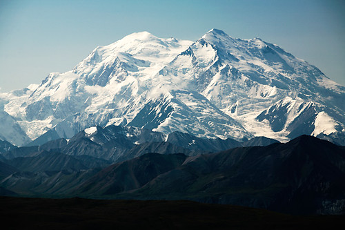
Mt. McKinley

This uncropped shot was taken at 200mm on my 5D (full-frame sensor) from a distance of 33 miles, at Eielson Visitor Center. Thirty-three miles, and it still filled the frame. Those little mountains you see at its base are about 7,000 feet tall; not exactly small.

I'd thought about lugging my 400/5.6 on this trip, but it's probably better that I decided not to. There was quite a bit of haze in the air from regional forest fires, so there's only so much sharpness and detail you can achieve, no matter how long your lens is. I had to up the contrast quite a bit in this shot to get the level of detail you see now. Luckily, I remembered to expose to the right without blowing out all the highlights, so pulling back the color and contrast wasn't a huge problem when I got home.

If you make it up to Denali National Park, I hope you're lucky enough to see Mt. McKinley in all of its massively huge glory too. Happy trails.

Tuesday, August 11, 2009

Pocket Ref


This is in no way related to Alaska, but I've been meaning to tell everyone about Thomas Glover's awesome little Pocket Ref. If you're planning to travel anywhere with less-than-stellar Internet availability (i.e. airplanes, Wyoming), then you need to drop a few bucks and get one of these. It's like having a little bit of Google, Wolfram Alpha, and Wikipedia in the palm of your hand. Want to know the difference between a cirrocummulus and a cumulonimbus cloud? Page 652 (with pictures). Want to know how to tie a blood knot? Page 537. Want to know the chemical composition of azurite? Page 342. Want to know how to convert from ounces to grams? Page 719. I could go on and on, but needless to say there's a lot of great stuff in this 5.6 ounce (158 gram) book. I found my copy at the bookstore hidden in with the dictionaries and thesauri. Check it out!

Monday, August 10, 2009

Savage Xpan

Ok, I've been bad about posting lately, but hey, I did just get back from Alaska. I plan to have several small posts about the trip in the coming weeks. I think it would take too long to write a huge post about the whole trip; just look at how long my PAGC post turned out to be.

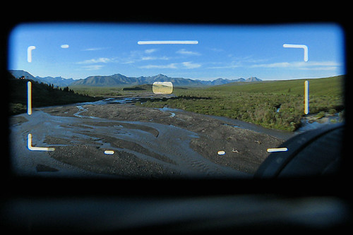
In the meantime, I thought you might enjoy this shot I took through the viewfinder on my Hasselblad Xpan. It was taken at Savage Creek in Denali National Park a couple hours after sunrise. The yellow box in the middle is the parallax focus area. The mounted lens is the 45mm, which only blocks a small corner of the viewfinder.

Savage Xpan

In case you were wondering, the shot through the viewfinder was taken with my little Canon SD800 in macro mode. Pretty cool.

Saturday, August 1, 2009

Denali Air

I'm sitting in the back seat of a Piper Chieftain. The pilot fires up the two props and taxis out to the end of the grass strip. A quick 180 points the plane toward Denali National Park.

Full throttle. The small plane rises so gradually, that it's difficult to tell whether we're still rolling on the grass. A quick glance down reveals that all is well. The tips of the tress are indeed below, and I'm suddenly glad that Piper blessed the Chieftain with two engines, not one.

The pilot banks west over Parks Highway, the Alaska route 3. We pierce the park's invisible wilderness boundary line and throttle back. Ground below, clouds above, Mt. McKinley ahead.

The headset clicks. Our ascent and pre-recorded audio tour is suddenly interrupted by the pilot. Dall sheep on the cliffs at 3 o'clock... not below, straight out the window. Perhaps I should reach out and grab some wool, but the comfort of the enclosed cabin makes me think twice. The pilot comments on the joys of flying below the clouds, between the peaks, now that the weather has cleared. Indeed.


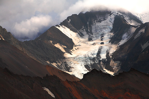
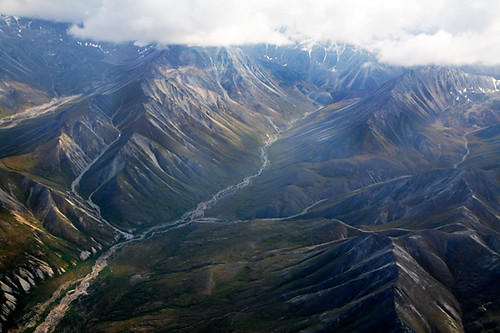
Denali AirDenali Air


Surrounded by cliffs, glaciers, and mountain passes, our plane dips and banks to their every breath. My back and hips absorb the undulations as though I'm riding on the back of a horse. The lens hood on my 24-105/4 occasionally bumps the Plexiglass window in spite of my attempts at stability. As the vastness of patterns and colors outside reveal themselves, there are simply too many pictures to take. Image stabilization is a wonderful thing.

Denali Air

Denali Air

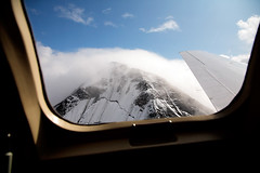
Suddenly, we've reached our destination. We're eye-to-eye with McKinley massif, or at least we should be. Clouds have moved in. The pilot offers to zoom us around to the west side of The Mountain in an attempt to get a clear view... for an extra $100 (each). A quick look at the clouds brings a quick consensus among the passengers. No thanks, McKinley can keep its cloudy reputation.

Our course dwells momentarily as the plane turns slowly east. We're graced with the same amazing cliffs, glaciers, and mountain passes on our return, and my 5D continues to click away. As we approach the runway, I switch to taking video with the SD800; no need to "turn off all electronic devices" here, thank you very much.

The landing is as smooth and gradual as the takeoff; much smoother than I've felt on most commercial airliners. The Chieftain rolls to a stop, and the pilot shuts down the right engine. After all, there's no need to taxi with two engines after a perfect landing.

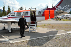
The plane is returned to its patch of tarmac. The pilot turns around and finds nothing but smiling faces. He tells us a little about the plane. Its engines are overhauled every 2000 hours. It spends its winters (September to June) in Anchorage. Personsonally, I prefer to winter in Miami, but Anchorage seems sensible. The pilot also mentions that he's been flying at Denali for 27 years; almost my entire life. Good to know.

After some pictures next to the plane, we return to the car. As we drive back to Riley Creek campground, we agree that Denali Air was a wise choice over the ATV tour. $250, 45 minutes, 180 pictures, and an unforgettable perspective of Denali; sounds like a deal to me.

Sunday, July 12, 2009

Pennsylvania Grand Canyon

For this year's 4th of July weekend, my girlfriend and I decided to get the flock out of the DC area and go camping at the Pennsylvania Grand Canyon (PAGC) in Leonard-Harrison State Park. We were definitely in vacation mode this time around, so photography was less of a priority. There would be no getting up at the crack of dawn for sunrise pictures, nor would we be rescheduling dinner around the sunset. Nonetheless, the 5D was with me, along with my new-ish 24-105/4 L IS.

We hit the Rattlesnake Rock Trail on our first evening. This trail had a really deep, dark feel to it. The trees ascended the mountain on the west side of the trail, making the canopy seem particularly thick. The creek along the tail provided a nice clearing through the dense forest. The trail head also had a cool meadow, pictured below. Just don't go wandering too far off the trail, several people reported seeing rattlesnakes nearby. I guess the trail lives up to its name.
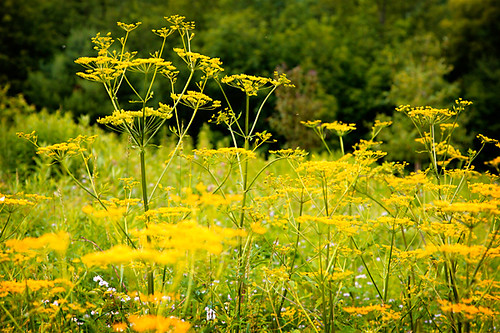
Rattlesnake Rock Trail

When we got back to the campsite, we decided to get the fire going. When we'd arrived around 1:30pm, most of the campsites were empty, and the park ranger said we were free to gather up as much wood as we wanted. The down side was that most of the wood had been left sitting out in mud and puddles for a while, so it was quite damp. The wood that was dry was often infested with a variety of ants. We were able to find a few good pieces though, and plenty of kindling. After persistently feeding the fire with kindling (along with the help of some lighter fluid), we finally got some hot coals to dry out more of the wood. The fire pits at Leonard-Harrison State Park are fitted with fold-over grates, which we used to hold up the cast iron skillet. After enjoying some pork chops, we hit the hay.

In spite of our best efforts to sleep in on this trip, we actually got up by 6am both mornings we were camping. The birds dutifully announced the sunrise, so we simply decided to get an early start on the trails. On the plus side, we didn't have to wait in line for the shower; there was only one for men, one for women, and one in the "family" restroom.

The second morning we decided it was time to hit the local tower overlook. When we got there, it was totally unmanned and looked about as rickety as a ride at a state fair. The entry gate was operated automatically via a credit card reader, which was somewhat unexpected given the tower's remote location. The charge was $3. I ended up having to swipe my card twice; I'd given the gate a half-push, which was enough to make it think I'd gone in, but not enough to actually move the gate. I'd recommend standing in the gate then reaching back to swipe your card rather than swiping then stepping in. In any case, morning was definitely the time to go, as we had the whole tower to ourselves, and the view was very nice. I imagine it would be even more spectacular at sunset. In hindsight, I'm also curious if we could have seen some distant fireworks that night.

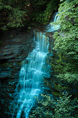
Once we were done at the tower, we decided to hit Leonard-Harrison's feature trail, the Turkey Path. Undiscouraged by the hazard signs at the entrance to the trail, we worked our way down, enjoying some of the best waterfall views I've seen outside of the Pacific Northwest. This is also where the image stabilization on my lens really amazed me. I was able to get some excellent shots of the waterfalls at 1/13 of a second hand held. While the optimal shutter speed for waterfalls is actually 1/3 of a second, 1/13 isn't bad and saves the time, trouble, and weight of a tripod. Here's a shot of Lower Little Four Mile Run Falls.
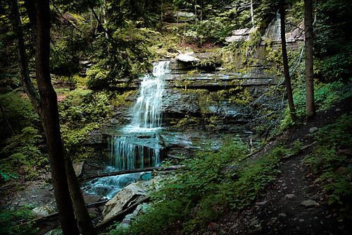
Lower Little Four Mile Run Falls

When we were done on the Turkey Path Trail, we headed over to Darling Run Station for some lunch and a walk along the Pine Creek Trail. We were vastly outnumbered by people on their bicycles on this long, smooth trail. The trail can get a little monotonous at walking speed, so I'd recommend biking it. Then again, from a bike, it would be difficult to get a shot like this:
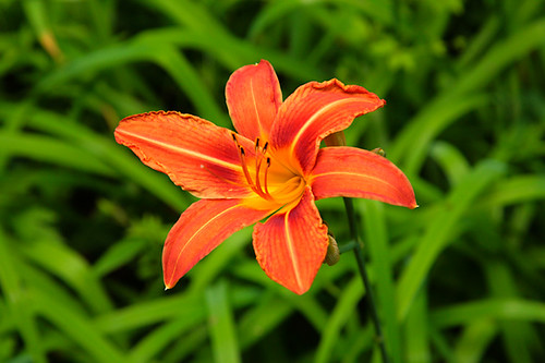
"Pennsylvania Grand Canyon"

After a lazy afternoon nap, and a beautiful drive up to Hammond Lake (and a brief stop at the Tioga Central Railroad), we decided to forgo the local fireworks and start on the fire instead. This time around, I decided to try a different fire starter... dryer lint. I was skeptical at first, but it just took a handful of lint under some kindling to get the fire going; no lighter fluid required. It probably helped that we had more dry wood to work with this time, but if you ever need fire starter, look no further than your dryer.

Whether you call it the "Grand Canyon of Pennsylvania" or the "Pennsylvania Grand Canyon", it's very cool, and well worth a stop.