Saturday, August 27, 2016
Check Twitter
Life has picked up pace a bit lately, so I've been making more use of the original microblogging service, Twitter, rather than writing full blog posts. In spite of its downtrodden stock price, Twitter seems to be indispensable in society these days. Check out my feed @thephotoway for the latest photos, tips, and other randomness. Thanks!
Sunday, May 10, 2015
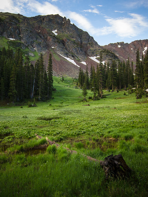
The Shot: San Luis Valley
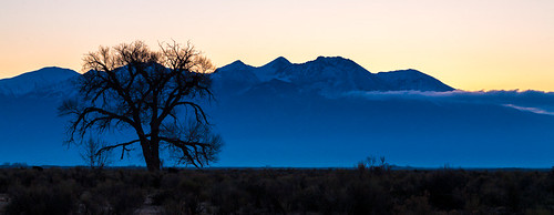
Canon 5D, 70-200/2.8, 100mm, 1/15, f/11, ISO 100, tripod, Lightroom 4
It takes over 30 minutes to get from Alamosa to Great Sand Dunes, which gives one time to think and observe. I came across this location along the way. There's a KFC sign right next to it, which is probably what most people notice, but it also makes a good landmark. Regardless, the specific location is 37° 28.427'N, 105° 46.970'W. There's a nice, wide shoulder, but make sure to pull off as much as you can since the cars are zipping along at a good clip on this unwavering portion of US-160.
This is obviously a sunrise shot, with the Sun coming up to the right of Blanca Peak. I'd hoped to capture more clouds, or to get a more active sky above the peaks, but that's all the more reason to return and try again. This shot could probably also work at sunset with Blanca Peak fully illuminated, though you'd have to ensure that the tree is darkened such that it would silhouette against the background.
Sunrise shots can be challenging in San Luis Valley with the mountains and extreme weather to the east. Don't even bother with sunrise at Great Sand Dunes, which buttes right up against the Sangre de Cristo Mountains. Luckily there are plenty of other rewarding locations in the area. Nearby Alamosa National Wildlife Refuge even has some water that can make for a good foreground on a still morning. There's plenty of time to explore in the middle of the day when the light is bad.
Get out there.
Sunday, May 3, 2015
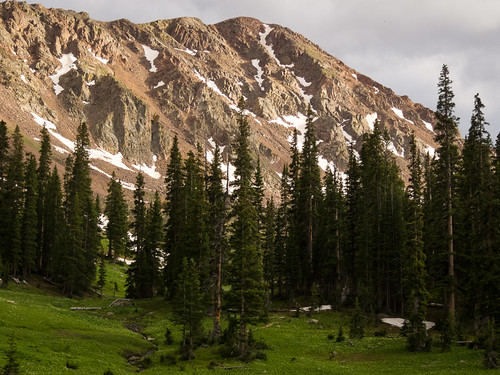
The Shot: Great Sand Dunes National Park
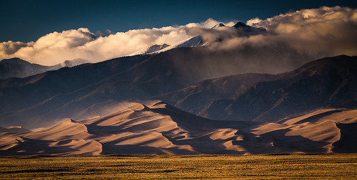
Canon 5D, 70-200/2.8, 200mm, 1/125, f/8, ISO 200, polarizer, tripod, Lightroom 4
This was somewhat inspired by QT Luong's post. In other words, the best shots of the dunes are not on the dunes. In fact the location is quite accessible. I always get annoyed with obscure directions to photo locations though when GPS is so ubiquitous. Timing is everything, so there's no time to reposition.
In this case, proceed to 37° 41.240'N, 105° 33.213'W along CO-150 about an hour before sunset. Any later, and the shadows of the dunes may be too long.
Use a polarizer. This is very important for getting the right light reflecting off the sand dunes at this angle. You'll see the immense difference as you rotate the polarizer into position.
For this shot, I was using a 70-200/2.8, but I was shooting at f/8, so you don't need the 2.8ness; a cheaper, more travel-friendly f/4 or 5.6 should be fine. I was shooting zoomed all the way in to 200mm. I tried a 400mm lens, but that didn't allow me to get the mountains in the background. You could probably get away with a 300mm, but that wouldn't get you as much width in the frame. Obviously, I cropped some of the top and bottom of this photo a bit in post.
As you can see by the sand coming off the tops of the dunes, the wind was whippin'. It was pretty relentless too. I recommend using a very solid tripod. Normally people go for lighter tripods, but you'll be right along the road for this shot, so a heavy, solid tripod should actually work in your favor. If you can, use your vehicle as a wind block too. Even with a good tripod, I still had a few shots come out blurry due to camera shake; the lens hood is great at catching those gusts of wind.
The San Luis Valley is an amazing place, even without the dunes. I highly recommend a visit. Happy shooting!
Thursday, December 25, 2014
Merry Christmas
Just a quick merry Christmas to everyone. 2014 has been quite a year, to say the least. 2015 should be full of possibilities.
Sunday, November 2, 2014
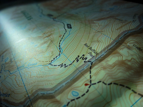
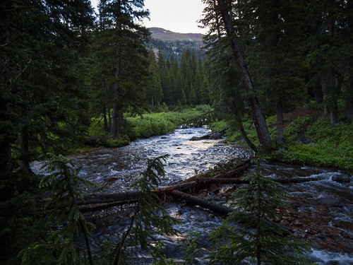
Gore Creek Trail
The plan was simple: hike four miles in, another four miles in, then eight miles back out, preferably downhill most of the way. The trick was finding the right trail. After pouring over maps for several hours in June, my friend Peter and I finally decided on the Gore Creek Trail near Vail.
After carbing up at Chipotle in Silverthorne, we drove over Vail Pass then hit the trailhead (39° 37.660'N, 106° 16.485'W) just off I-70. The trail was steep and hot; not a good start. As we moved east up the creek valley, our cell phones lost signal, and some cooler clouds rolled in. The situation was improving.
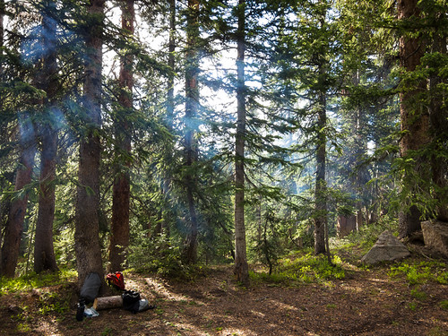
We reached camp 1 (39° 37.492'N, 106° 12.314'W) as the afternoon ended. Eager to beat the darkness and any additional weather, we threw up the bear lines and set up the tent in one of the flatter areas we could find off the trail, back in the trees. Since the trail was part of the Eagles Nest Wilderness, the rules were clear, but there were no official spaces for anything. In other words, do your best. We considered taking the steep side trail up to Gore Lake, but time and weather were against us. Instead, we examined the small Swedish grave site and explored our options for fording Gore Creek the next day. We waved to some passing day hikers, not realizing that they would be the last people we'd see for a while. We were on our own.
Our dinner consisted of 9-year-old Mountain House Chicken Teriyaki, which was best described as "edible." It was time to pack it in.
The next morning was sunny enough to dry out the tent next to the grave site. After some breakfast and instant coffee, it was time to cross the creek. While the water was only knee-deep, it was also flowing at a fairly good pace. I only had one trekking pole to stabilize with. The rough, slippery creek bed was murder on my bare feet. Peter had his camera up and ready to get the action shot of me falling in. Thankfully that never happened.
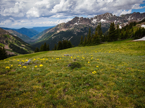
Once across and reassembled, we were rewarded with one wildflower meadow after another as our hike continued further up the valley. The open spaces and surrounding mountains made us want to stop and keep going at the same time. It just got better and better.
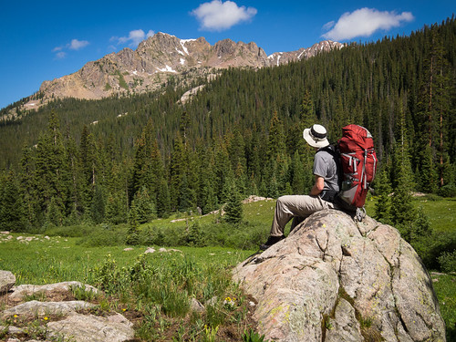
After another, much easier creek crossing, we made it to camp 2 (39° 37.025'N, 106° 10.985'W) around lunch time. We'd made it to the western base of Red Buffalo Pass, an open meadow surrounded by 12,500 foot peaks.
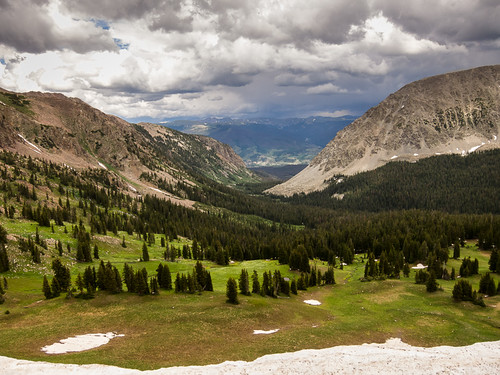
We set up camp, threw together our day packs, and headed east for the pass. At this point we were already at 11,000 feet at the start of the trail, and my lungs were reminding me of this every step higher. As we worked our way up, the view to the west revealed the entire Gore Creek valley we'd just traversed. Stop. Catch breath. Eat protein gummies. Drink water. Take pictures. Repeat.
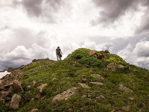
Perseverance, and Peter's patience for me, eventually got us to the top of the pass. We were in the land of marmots and glaciers, well above the treeline. The views were nothing short of spectacular, with glacial lakes, Eccles Pass, Buffalo Mountain, and Silverthorne to the east, Red Peak to the north, and Gore Creek Valley to the west. We could have stayed all day, but a thunderstorm snuck up on us. Trail running has never been my thing, but lightning has a way of motivating.
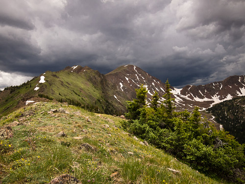
Being back at the bottom of the pass wasn't a bad place to be. As evening set in, beams of sunlight shot under the clouds, through the creek valley, hitting the peaks and meadows around us with the kind of light painters dream of.
The night was uneventful, and surprisingly warm for 11,000 feet. That morning we took a few more pictures, then packed up early for the trek down to the trailhead.
It had been about 36 hours since we'd encountered another human being. Half way back to camp 1, we came across a group headed for Red Buffalo Pass with some very large packs, and a couple of light-and-fast hikers doing the whole trail through in one day; I can see the appeal of the latter. As our altitude dropped, the temperature started to climb, and the moist ground that was covered in wildflowers gave way to dry scrub brush. A couple open rock faces along the way gave us a chance to dry out the tent in the Sun and enjoy a bit more scenery.
It had been an amazing hike. I can see why the really great photos are taken a bit off the beaten path. At our most remote point, we were over four miles from the nearest road. We did have a little bit of cell service at the very top of Red Buffalo Pass, but we were completely out of contact during our entire time in the Gore Creek valley, which is the way it should be.
Whether you're a foot, a mile, or 20 miles out there, the point is that you're out there. These photos were all taken with the tiny Canon S95, but that doesn't really matter. Happy shooting.
Subscribe to:
Posts (Atom)

